Wednesday, December 31, 2014

Karez System----- 'the underground Great Wall'

Karez is a unique irrigation system mainly distributed in Turpan district in Xinjiang Uighur Autonomous Region. Karez systems are the crystallization of ancient people's diligence and intelligence. At its peak, this irrigation system exceeded 5,000 km (3,106 miles) and was also referred to as 'the underground Great Wall'. It is among the three ancient major irrigation projects with the other two being Ling Canal and Dujiangyan Irrigation Project. The history of it can be traced back over more than 2,000 years ago.
Karez systems are the life source of Turpan. In a sense, without them, there would be no Turpan culture. According to records, the history of the karez in Xinjiang dates back to 103B.C. Karezes have been found in Iran, the Sahara, etc., but the ones in Turpan are the most complete. Currently there are still over 400 systems.
Karez are very delicate irrigation systems made up of vertical wells, underground canals, above-ground canals and small reservoirs. Generally, a karez is 3 km (1.9 miles) with the longest being 20 to 30 km (12-19 miles) with several dozen vertical wells. Sometimes the number of vertical wells exceeds 300. Until today, the shortest karez found is only 30 meters (98 feet) long. The vertical wells are for ventilation, digging and maintenance of the karez. The bottoms of all the vertical wells are connected so that water can pass through. The underground canal is about 2 meters (6.5 feet) high and covered with earth to resist the heat. The surface canals, connected to the underground ones, are not more than 1 meter (3.2 feet) wide with trees planted on both sides to prevent evaporation.
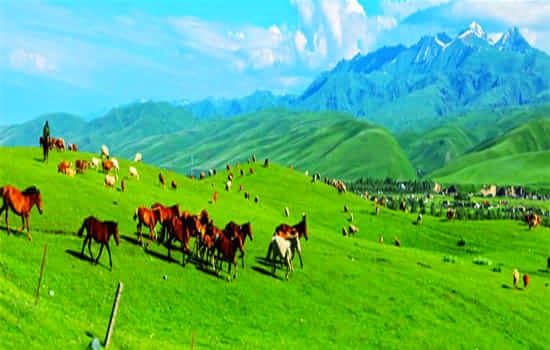
Melting snow from the Tianshan Mountain is the water source of the karez. Water is collected by vertical wells and conducted by the underground canals to the oasis, where the water is held in the ground canals for irrigation. The vertical wells near the water source may be 100 meters (328 feet) deep while further downstream they are less than 10 meters (32.8 feet) deep.
There are more than 1400 Karez wells in Turfan. They also play the roles of natural air conditioner for the locals because they can sit in one while chatting or doing some chores. When exhausted during the scorching weather, sit in a karez, pick some grapes as they hang over the vertical wells and savour their taste, you will be thoroughly refreshed! Karez System really makes you understand how the people of Xinjiang have brilliantly managed the water supply in this desertic land.
For more information, please visit http://top-chinatour.com

Tuesday, December 30, 2014

Nalati Grassland-----‘The Sky Grassland’

Nalati Grassland, one of the world’s four largest grasslands, it is locates to the east of Nalati Town of Xinyuan County. It is the highest prairie in China with lush grassland and surrounding mountain and a home of meadow vegetation. Owing to its high altitude and steep terrain, it is also called ‘The Sky Grassland’. It has been a famous pasture since ancient times.
A beautiful story is associated with the grassland. During the last years of the Southern Song Dynasty (1127-1279), Genghis Khan made a west expedition to Ili in midsummer. However, it was very cold in the mountains, further exhausting the already hungry soldiers. To their surprise, after crossing a mountain, they saw a boundless stretch of grassland. Dainty flowers were in full bloom and clear streams murmured over the lush green grass. It looked like a marvelous wonderland, so soldiers shouted happily ‘Nalati, Natati’.
Nalati scenic area covers 400 sq km of the country's second largest grassland. The grassland has quiet streams, fresh air and abundant vegetation. It is home to a 10th of China's Kazakh community, and its rolling hills are dotted with their camps. The landscape is carpeted with wild flowers, upon which wander herds of goats, sheep and cows. A must-do in Nalati is staying a night in a Kazakh camp.
From June to September, the vast expanse of lush grassland is dotted with colorful wild flowers. The surrounding snow mountains, white clouds, blue sky make this grassland more charming. Thus, this period is the best time to visit this wonderland. Many activities are held in this ‘Cradle of Kazaks’. Kazakhs who are good at dancing and singing live here still retains the rich simplicity of folk customs and rich grassland culture. Unique natural landscape, history, culture and rich ethnic customs make Nalati Grassland Scenic an unique place to go.
For more information, please visit http://top-chinatour.com

Monday, December 29, 2014

Hetian Museum

Built in 1995, Hetian Museum has an area of 3400 square meters. It boasts over 9000 pieces of cultural relics; most of which were discovered by archaeologists after 1949 and a small number were donated by the locals. Hetian museum opened in 2005, it is located on West Beijing Road in Hetian, Xinjiang. The main halls are situated on two floors and display the historical relics and items reflecting the present local folk customs respectively.
Hetian, being the largest oasis on the south of Taklamakan Desert, was the territory of many ancient regimes such as the Kingdom of Khotan. Many ancient cities and tomb sites have been discovered in this area and these include the Shanpula tombs, the Niya and Mazhatage Sites and the site of the ancient Yuansha city. Many relics and models of these tomb sites are exhibited in this museum and give people a chance to get close to this place and learn about the culture of western regions in ancient China.
The Hotan Cultural Museum exposition is divided into two parts. On the ground floor, there is a collection of monuments of ancient civilizations, once existed in the territory of Eastern Turkestan. There you can see ceramic ware, jewelry, and household items. In addition, the museum features fragments of ancient tombs and sarcophagi, which are several thousand years old. One of the most valuable exhibits is considered two mummies of a girl and a man who are more than 1500 years old.
The museum’s first floor holds a collection, unofficially called the Uighur one. It opens an amazing and colorful world of Uighur culture to the museum visitors. There you can see ancient clothing and jewelry created by the hands of the ancient masters, as well as various Uighur artware. On the second floor, Hetian Uygur folk culture is illustrated by exhibits of local jade and carpets, the local silk, Uygur dresses, folk art and handicrafts, as well as Uygur medicine and food culture. Among the prized relics in this hall are a carpet into which a map of China is woven and a large copper pot.
The collections in the Hetian Museum provide a vivid picture of the splendid culture of ancient Hetian area in the fields of manual textile technology, art pottery, painting art and the Buddhist culture.
For more information, please visit http://top-chinatour.com

Sunday, December 28, 2014

Sayram Lake-----the Largest Alpine Lake in Xinjiang

Sayam is enchased in the hinterland of TianshanMountainIt is 93.6 kilometers southwest of the Bole City, on the north side of the Urumchi-Yining RoadSayram in Kazak means blessing while in Mongolia means lake on the mountain ridge”.The lake is the largest alpine lake in Xinjiang and lies at the highest altitudewith a height of 2,072 meters above sea levelIt is about 29.5 kilometers long from east to west and about 23.4 kilometers wide from north to south, occupying an area of 458 square kilometersThe lakeabout 90 meters deep at the greatest depthholds 21 billion cubic meters of water.
Thc Sayram Lake is on the northern Silk Roadand present Urumqi-Ili highway runs along the Southern bankBeside the lake and on the mid-lake islandhistoric spots like the Longwang Temple (Dragon King Temple)the Hai Templeand other constructions once were buntbut now all have unfortunately disappeared.
There is a touching love story about Sayram Lake. It is said that it was composed of the tears of a couple of Kazak young lovers. A beautiful girl and a young man were deeply in love. One day, a cruel devil was captivated by the girl's beauty. He captured the girl and confined her to his residence. The girl took a chance to escape, but the devil found out very soon and went after the girl. She was forced to jump into an abyss. Later, her boyfriend heard of this and he was so sad that he jumped into the abyss to be reunited with his lover. Their painful tears flooded into the abyss and formed Sayram Lake.
The scenery is quite varied in four seasons. In the springsummer and autumn the sapphire water of the lake seems to meet the sky in the distanceThe pasture is a charming scene of flourishing treeswaving grassand wildflowers that are reflected in the clear water of the lakeIn the winter, snow falls and the water of the lake turns to iceOnly a Small portion of the lake can be seen in the vast whiteness of the ice and snow.
In July and August, local 'Chahra' Mongolian and Kazakh herdsmen converge onto the pasture to hold a grand festival, known as the Nadam Festival. Mongolian people celebrate the "Nadam Fair" for six days beside the lake. Nadam means recreation or games in Mongolian. During the Nadam Fair, competitions are held in horse-racing, wrestling and archery, which are considered the three basic skills of men. Mongolian, Kazak, Han Chinese and people of other ethnic groups in Xinjiang participate in the festival. Mongolian herders from nearby regions attend the fair and dress in traditional ethnic costumes. In addition to the competitions, there is singing, dancing and the age-old competition of "girl-chasing". The Kazak horse back games of "Buz Kashi" and "Girl-Chasing" promise a rich cultural experience of the well-preserved traditions unique to this remarkable region. The fair is great fun for tourists and very entertaining. It is rewarded with lasting impressions of a cultural continuum that has its roots in the beginning of Central Asian history. During this time, Sayram Lake is blessed with a double portion of good fortune in water and pasture.
For more information, please visit http://top-chinatour.com

Saturday, December 27, 2014

Lop Nur

Lop Nur which means a vast lake is a former salt lake in China, now largely dried-up. Located in the northeast of Ruoqiang County, Lop Nur is about 780 meters (2,560 feet) above sea level and covers an area of about 3,000 square kilometers (1,160 square miles). Once it was the second largest inland lake in China and an important station on the Silk Road.
The lake system into which the Tarim River and Shule River empty is the last remnant of the historical post-glacial Tarim Lake, which once covered more than 10,000 km2 (3,900 sq mi) in the Tarim Basin. Lop Nur is hydrologically endorheic— it is landbound and there is no outlet. The lake measured 3,100 km2 (1,200 sq mi) in 1928, but has dried up due to construction of dams which blocked the flow of water feeding into the lake system, and only small seasonal lakes and marshes may form. The dried-up Lop Nur Basin is covered with a salt crust ranging from 30 cm to 1 m in thickness.
In the broad sense, Lop Nur refers to the Lop Nur desert area which spans Xinjiang and Gansu Provinces. The Spectacle of the Gobi Desert and some historical sites are also scattered in this area, including the dragon-shaped Yadan Landscape, Rose-Willow Valley, the Peacock River, a dead forest of diversiform-leaved poplar (populus diversifolia), a Han Dynasty (206BC-220AD) beacon tower, the Sun Tombs, the Milan Farm and the Loulan Ancient City.
Situated on the northern bank of the Peacock River, the Sun Tombs have a history of about 3,800 years. Around each tomb are seven circles formed by wooden spikes pointing toward the sun. The tombs are full of mystery. No one knows who were buried there and where they were from.
The Loulan Ancient City is one of the great mysteries in Chinese history. It existed for only 400 years or so, disappearing in the 4th century. Its disappearance is still a riddle. The 'Loulan Beauty' (a female mummy), tombs and colorful coffins attract explorers, historians and visitors to the area.
Xioahe Tomb is also famous to people. The Xiaohe Tomb complex is located to the west of Lop Nur. This bronze-age burial site is an oblong sand dune, from which more than thirty well preserved mummies have been excavated. A total of 167 tombs have been dug up since the end of 2002 and excavations have revealed hundreds of smaller tombs built in layers, as well as other precious artifacts. In 2006, a valuable archeological finding was uncovered: a boat-shaped coffin wrapped in ox hide, containing the mummified body of a young woman. She was called “Princess Xiaohe” because she was found at Xiaohe. The most amazing thing is that her hair was preserved very well and people can see the smile on her beautiful face.
Lop Nur is a paradise for visitors who love adventure. There are some suggestions for the adventurers. First, go there in the middle of April and October to avoid strong sandstorms. Second bring enough food, water and necessary medicines. Last but not leastdo not forget satellite phones, GPS or other communications tools
For more information, please visit http://top-chinatour.com

Friday, December 26, 2014

The Ruins of Ancient Niya

The archeological site known as Niya (hereafter referred to as the Ruins of Ancient Niya), which lies deep in the Takla Makan Desert on the southern rim of the Tarim Basin in present-day Xinjiang Uyghur Autonomous Region, has been called the Pompeii of the East, owing to Niya having been buried, quite suddenly, as had ancient Pompeii ages earlier. Or so it seems, for no one really knows what caused the residents of Niya to abandon their city in such a panic that they even left their dogs tethered in front of their houses, apparently fleeing for their lives from some unknown-to-us, impending calamity.
Located in the desert 150 kilometers (approximately 93 miles) from Minfeng County in Hotan, it is a major national cultural relic According to historical records, it was once the site of the Jingjue Kingdom which was occupied by the western minorities in ancient China. It was an oasis located deep in the Takla Makan Desert, lying to the north of Niya River. It was a famous kingdom among the 36 kingdoms located in that area. Like Pompeii, it was once prosperous but suddenly disappeared. No one knows the actual reason. Some people believe that it was destroyed by war, but others believe that it was destroyed by wind-blown sand.
The ancient city is surrounded by rolling sand hills and was first discovered in 1901 by a British explorer. Wooden implements, stone implements, bronze wares, iron wares, pottery, woolen goods and even remnants of food such as wheat, highland barley wild oat, mutton, and pork were excavated. The cotton clothes unearthed are regarded as the earliest cotton textiles that can be found in China. The relics of amanuensis including imperial edicts, public documents, and letters are valuable material for studying the history of minorities in ancient China. A site used for smelting iron in the Han Dynasty (206 BC - 220) was also discovered near site of this ancient city. The relics unearthed provide precious and accurate information that is very useful in studying the ancient minorities in China, the history of Silk Road and the cultural exchange between China and foreign countries. 
Nowadays, the local Cultural-Relic department has set a Cultural-Relics Agent who imposes a high fee to the exploration teams. In order to develop the travel industry, a sealed access road has been constructed. Here you can also see the relics of houses, courtyards, furniture, artwork, Buddhist pagoda, and coffins, each of which was made by drilling on one log.
For more information, please visit http://top-chinatour.com

Thursday, December 25, 2014

Tian Shan Mountains

Tian Shan Mountains is a large system of mountain range situated in the Eurasia hinterland. Tian Shan lies to the north and west of the Taklamakan Desert and directly north of the Tarim Basin in the border region of Kazakhstan, Kyrgyzstan and the Xinjiang Uyghur Autonomous Region of western China. In the south it links up with the Pamir Mountains and to north and east it meets the Altai Mountains of Mongolia. It also extends into the Chinese province of Xinjiang and into the northern areas of Pakistan, where it joins the Hindu Kush.
It is the furthest mountain system from the sea with widespread drought regions. The highest peak in the Tian Shan is Victory Peak (Jengish Chokusu), 7,439 metres (24,406 ft). As one of the Seven Mountain Systems in the world, Tian Shan Mountains stretches through four countries (China, Kazakhstan, Kyrgyzstan and Uzbekistan) with a length of 2,500 kilometers (about 1,553 miles) from east to west. With its particular geological structure and stunning natural landscape, the mountain has been inscribed in the World Heritage List by the UNESCO on June 21st 2013.
In addition to the highest peak, there are tens of peaks along the Tian Shan Mountains including Khan Tengri (China-Kazakhstan border) and Bogda Peak. Owing to the high latitude and high altitude, those peaks are covered with ice all year round. And what makes the Tian Shan Mountains more remarkable is that a high mountain lake - the Heavenly Lake. About 110 kilometers (68.4 miles) away from Urumqi, the lake is located in a valley at 1,943 meters (6,375 feet) on the northern slope of Bogda Peak. The melt water in the lake is crystal clear and quiet like a mirror, which is very beautiful with reflection of the snow peaks and jade green spruces.
Although many peaks of Tian Shan Mountains are covered with snow all the year round, the mountain area under snow line is still abundant in animals and plant resources. Vegetation there is under rich diversity, including dense forest, green spruce, whirl pines and more than 80 species of medical plants, especially the most precious herbal medicine - Saussurea Involucrate. Being adapted to harsh climates of high altitude, it grows well on cliffs and in the clefts of rocks along the mountain. Aside from Tianshan Wild Animal Park, which is located at the southern foot of Bogda Mountain, the Southern Pasture and Ili Nalati Grassland are also famous tourist attractions along the Tian Shan Mountains which are highly recommended for visitors who enjoy horse racing and the kazakh folk customs.
The Heavenly Lake Scenic area of Tian Shan Mountains is the most popular tourist attraction and it is close to Urumqi, so tourists are recommended to stay in hotels in Urumqi city and take through bus to the scenery spot.
For tourists, the best time to travel to Tian Shan Mountains is in summer from June to August when there are beautiful grasslands, cattle and sheep flocks and boundless rape flowers. Besides, for those who favor to enjoy the snow, they are suggested to visit the Mountain before December or after February because the mountain climate between December and February is severe cold and often with strong wind. Take along enough warm clothes even if you plan to visit in summer due to the big temperature difference between day and night in the mountainous areas. Also, pay attention to weather changes before visit, especially, the weather forecast for sandstorms.
For more information, please visit http://top-chinatour.com

Taklamakan Desert-----the Largest Desert in China

The Taklamakan Desert, also known as Taklimakan and Teklimakan, is a desert in southwest Xinjiang Uyghur Autonomous Region, northwest China. Taklamakan Desert is China's largest desert. This is reputed to be the world's second largest shifting-sand desert covering an area of over 33, 700 square kilometers (over 13,000 square miles).
In Uigur language, Takla Makan means 'you can get into it but can never get out' and the desert has another name 'the Sea of Death'. The desert is regarded as being very powerful among the people; no wonder the name connotes fear. But there was an interesting legend about its origin. It was said that there was a Supernatural Being, who saw the hardship being faced by the people in this area and thought that he could help them by using the two magic objects in his possession namely the golden axe and the golden key. He gave his golden axe to the Kazakh, so they split the mountain Altai and diverted water from the mountains to the fields. The Supernatural Being planned to give the golden key to the Uigur so that they could open the door of the treasure-house of the Tarim Basin, but unfortunately his youngest daughter lost the key. This angered him so much that he held her a captive in the Tarim Basin and thus the Takla Makan Desert was formed.
Continuous sand dunes in this large Takla Makan Desert are usually over 100 meters high (over 109 yards) and some are even higher than 300 meters (about 328 yards). Because of the wind, the sand dunes are always moving forward and statistics suggests that each year they move about 150 meters (about 164 yards), which seriously threatens the existence of oasis and the survival of the local populace. For the past 50 years, the Chinese Government has made great effort to plant trees to reduce the encroachments of the sandstorms. With the help of experts, local people planted diversiform-leaved poplars, rose-willows, pomegranate trees, mulberries and built windbreak belts as corrective measures and in some places, people even cultivate corn. There is an improvement in the living condition of the local people, thanks to the increase in vegetation. Now there are over 80 species of birds' resident in the interior desert and the precipitation is increasing as well.
The Takla Makan Desert is also rich in natural resources, buried under it vast expanse are resources such as groundwater, oil and oil gas. During the oilfields' opening up, people encountered the problems of transportation. Thus the idea of building a highway came to people's mind. In the year 1995, a desert-road of 522 kilometers (more than 324 miles) was completed and opened to traffic. Construction work has commenced on the second desert-road in June, 2005 and it is to be completed by the end of 2007.

There is very little water in the Taklamakan Desert and it is hazardous to cross. Merchant caravans on the Silk Road would stop for relief at the thriving oasis towns. It was in close proximity to many of the ancient civilizations—to the Northwest is the Amu Darya basin, to the southwest the Afghanistan mountain passes lead to Iran and India, to the east is China, and even to the north ancient towns like Almaty can be found. There are also some oases. Tourists can stop and have a rest.
For more information, please visit http://top-chinatour.com

Tuesday, December 23, 2014

Yadan Spectacle

'Yadan', which means 'steep mound' in Uygur, is now widely used by geologists and archeologists to refer to certain geomorphic features in arid regions. Because wind in this area is strong and frequent, landforms of wind-erosion are easily formed. These landforms present all kinds of shapes under a dusky sky. Sometimes they are an enormous army with invincible and mighty vigor. Sometimes they become many whales playing in the desert sea. Sometimes they are pavilions while at other times they are mysterious castles. This is what scientists call a Yadan landscape.
Yadan Spectacle is situated in the north of Ruoqiang County, Bayingolin Mongolian Autonomous Prefecture of Xinjiang Uygur Autonomous Region, in the Lop Nur Area. Lop Nur Area is the second largest Yadan area after the Qaidam Basin. The cluster of eroded mounds are scattered mainly in the north, west and east sides of the Lop Nur Area.
The east side of the Lop Nur Area has typical Yadan features; usually a mound is about 10-20 meters (around 33-66 feet) high with an average length of over 200 meters (over 656 feet). Most mounds are covered with a thick crust of salt and in the sunshine these mounds shine like silver. Looking from afar, they appear to be just like white dragons lying in the desert. Local people call this area 'White Dragon Mounds'. 'White Dragon Mounds' provided a natural defense for the Ancient City of Loulan, and is an area one must pass through en-route to Loulan.

There is an ancient city called Loulan in Xinjiang is in the west of Lop Nur. The Ancient City of Loulan played a very important role on the Silk Road. Chinese silks, tea, and jewelries were firstly exported to other regions and countries through the Ancient City of Loulan. Every time trade caravans passed through this kingdom they would stop to rest. Loulan Kingdom was established before 176 BC. It was a relatively prosperous kingdom at that time. What puzzled many historians, was that this kingdom suddenly disappeared after hundreds of years of being prosperous and flourishing. The reason for its disappearance is still a mystery. 
The remains of the Ancient City of Loulan cover an area of 12,000 square kilometers (about 4,633 square miles). An old waterway runs through the city dividing the city into two parts, the northeast part and the southwest part. The most notable remaining construction of this ancient city is three houses. The walls of these three houses are the only structures built with earth brick. They directly face the south city gate. 
Yadan Spectacle is situated in the desert area, so the climate is not so pleasant. Before visiting it, one must make necessary preparations, for example, one must take enough food, water, clothes, an umbrella to protect against either the dazing sunshine or a rain, and if possible a pair of sunglasses.

For more information, please visit http://top-chinatour.com

Monday, December 22, 2014

Iron Gate Pass (Tiemen Guan)

Located 8 kilometers from Korla City, The Iron Gate Pass connects the Yanqi Basin and the Tarim Basin in central Xinjiang. The pass follows the gorge of the Kongque River. The main settlements linked by the pass are the town of Yanqi in the Yanqi Hui Autonomous County to the north and the city of Korla in the Bayin'gholin Mongol Autonomous Prefecture in the south. It is one of the 26 famous passes in China, and acquired the name 'Iron Gate' for it is solid and firm just like an iron gate. The Iron Gate Pass was of historical strategical significance because it formed a vulnerable bottle-neck on the Silk Road.
The pass is part of an arduous section of the Silk Road which one needed to travel to reach Tarim Basin (located in Xinjiang, the largest interior basin in China). The pass lies in Tieguan Gorge which has been a strategic location since ancient times. A famous poet named Cen Sen in the Tang Dynasty (618-907) once wrote a poem depicting the steepness of the pass. In his poem the gate is a place where people worry seriously about how to pass through, and where persons are rarely seen. Looking upwards, you can only see the cliff; looking downwards, the torrential water rushes with waves churning in Kongque River.
Many tourists come to visit the gate because they are attracted by a famous love story. The story is set in ancient time and tells of love between a princess and the son of a minister. They fell in love but this is opposed by the King, the father of the princess, and the King's evil advisor. Under pressure from the King and persecution by the advisor, a final tragedy happens: The princess and the young man suffered so much that together they ultimately leaped to their death into Kongque River. In order to commemorate the two youngsters who sacrificed their life for love and freedom, a tumulus where they are buried together was built on the Gongzhu Ling opposite the gate.
At present, the pass is no longer part of the road infrastructure of the region and is preserved as a scenic and historical area. The modern road (G218) from Yanqi to Korla passes through the mountains to the east of the gorge. As a result of the efforts of architects, sculptors, and artists, the gate has become an example of excellent architecture which attracts some 300,000 tourists every year.
For more information, please visit http://top-chinatour.com

Sunday, December 21, 2014

Kizil Thousand-Buddha Caves----the Earliest Buddhist Art Treasure in China

The Kizil Caves are a set of Buddhist rock-cut caves located near Kizil Township in Baicheng County, Xinjiang. The site is located on the northern bank of the Muzat River 65 kilometres (75 km by road) west of Kucha. This area was a commercial hub of the Silk Road. Cut the third century to eight or ninth century, it is the earliest Buddhist art treasure trove in China, even one century earlier than the famous Mogao Grottoes. Currently there are 236 coded caves preserved, which are divided into west and inner valley and rear mountain areas extending to over 3 kilometers (1.86 miles). On June 22, 2014, it was included in the World Heritage List.
The Kizil Thousand-Buddha Caves are corridor of murals surpassing other existing caves in China in its abundance in content, quantity and long duration. It is significant in Buddhism as well as in the history of Qiuci. The earlier caves took the shape similar to Bamian Caves and the murals suggested the influence of Gandhara arts, a Buddhist visual art prevailing in today's Northwestern Pakistan and Eastern Afghanistan in First Century B.C. and Seventh Century A.D. The written documents discovered here were composed in Tocharian B language, a branch of the Indo-European language family that originated in central Asia during the first millennium.              
       
The Kizil Thousand-Buddha Caves come in two forms, one as living quarters with earthen bed and simple facilities, and the other one as temple for worshiping. Caves of different form and function were combined into one unit. It is assumed that one unit was one temple. This is to say that temples stood shoulder to shoulder in the Kizil Thousand-Buddha Caves at that time.
The murals in the Kizil Thousand-Buddha Caves are reputed as "The most beautiful murals in Central Asia". They are found in 81 caves with a total area of more than 10,000 square meters (11,960 yards). The diamond grid pattern is the most impressive feature. There is a story about Buddha's reincarnation in every gird. Each story was portrayed by a single picture instead of a series of pictures as in Mogao Grottoes.
Besides the themes of Buddha, Bodhisattva, Arhat, Flying apsaras, and Buddhist fables, a variety of depictions on production and daily life, farming, hunting, pastures, riding, mountains and rivers in the West Region, animals, birds and ancient architectures can also be seen in the Kizil Thousand-Buddha Caves. The styles were not limited to the local arts. Traditional Central Chinese painting styles were also popular. All these revealed advanced art achievements in Qiuci. The No. 38 Cave (Music Cave) murals here proved this as a case in point sufficiently. The murals depicted a scene of Qiuci band with20 musicians playing their respective instrument, on both sides of the cave. Amazingly, it was found out that looking closely into the gestures and position of the musicians' hands on the instrument, all stopped at the same meter!
For more information, please visit http://top-chinatour.com

Saturday, December 20, 2014

Bosten Lake----- a Bright Pearl of the Oasis

Bosten Lake is a freshwater lake located on the northeastern rim of the Tarim Basin, about 20 km east of Yanqi. Covering an area of about 1,000 km2 (together with adjacent small lakes), it is the largest lake in Xinjiang and one of the largest inland freshwater lakes in China.


Bosten is Mongolian, and means 'stand-up' in Chinese. There are three hills standing in the central part of the lake, hence its name. It was once named 'West Sea' and 'Qin Sea' in the Han Dynasty (206BC-220), 'Bosten Lake' and 'Fish Sea' in the Tang Dynasty (618-907), 'Yanqi Sea' in the Ming Dynasty (1368-1644), and was finally named 'Bosten Lake' in the Qing Dynasty (1644-1911).
Bosten Lake is rich in aquatic life with beautiful scenery, being famous as 'a bright pearl of the Oasis'. It is rich in fish and reeds, and is the largest fishing area of Xinjiang Province and one of the four biggest reed producing areas in China. It became a tourist site in the late 1980s, built with wharf at A Hong Kou where you can look over the beauty of Bosten Lake, the sand sculptures of Bailu Zhou (Egret State), and the volleyball facility at Jin Sha Tan (Golden Sand Beach), and many other attractive scenic spots.
Bosten Lake is a tourist attraction that gladdens the heart and pleases the eye. Meanwhile, in May 2002, Bosten Lake tourist spot was approved as the provincial tourist spot by the State Council. Bosten Lake is not only rich in reeds, wild animals but also the rare animals such as the yellow goats and the wild deers. Bosten Lake is one of the fishery bases of Xinjiang as well as one of the four reed growing areas in China. In summer, people can organize rich, varied and colourful activities on the lake, and in winter Bosten Lake becomes another wonderful place for people to enjoy themselves on the ice. So it is described as both a summer resort and a heavenly place.
For more information, please visit http://top-chinatour.com